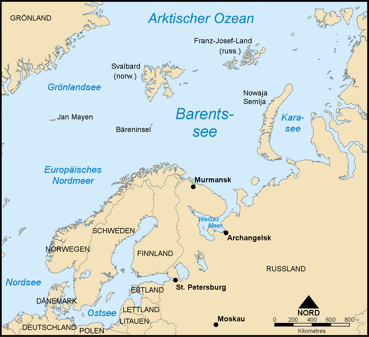
The researchers base their assumptions on simulations with an elaborate computer model of general circulation, ECHAM5, focusing on the Barents-Kara Sea north of Norway and Russia where a drastic reduction of ice was observed in the cold European winter of 2005-06. Those surfaces of the sea lacking the ice cover lose a lot of warmth to the normally cold and windy arctic atmosphere. What the researchers did was to feed the computer with data, gradually reducing the sea ice cover in the eastern Arctic from 100 percent to 1 percent in order to analyse the relative sensitivity of wintertime atmospheric circulation.
“Our simulations reveal a rather pronounced nonlinear response of air temperatures and winds to the changes of sea-ice cover,” Petoukhov, a physicist, says. “It ranges from warming to cooling to warming again, as sea ice decreases.” An abrupt transition between different regimes of the atmospheric circulation in the sub-polar and polar regions may be very likely. Warming of the air over the Barents-Kara Sea seems to bring cold winter winds to Europe. “This is not what one would expect,” Petoukhov says. “Whoever thinks that the shrinking of some far away sea-ice won't bother him could be wrong. There are complex teleconnections in the climate system, and in the Barents-Kara Sea we might have discovered a powerful feedback mechanism.”
Other approaches to the issue of cold winters and global warming referring to reduced sun activity or most recently the gulf stream “tend to exaggerate the effects,” Petoukhov says. The correlation between these phenomena and cold winters is relatively weak, compared to the new findings referring to the processes in the Barents-Kara Sea. Petoukhov also points out that during the cold winter of 2005-06 with temperatures of ten degrees below the normal level in Siberia, no anomalies in the north Atlantic oscillation have been observed. These are fluctuations in the difference of atmospheric pressure between the Icelandic low and the Azores high which are commonly associated with temperature anomalies over Europe. But temperatures in the eastern arctic were up to 14 degrees above normal level. However, distinct anomalies in the north Atlantic oscillation could interact with sea-ice decrease, the study concludes. One could amplify the other and more anomalies would be the result.
Petoukhov’s study is not about tomorrow's weather forecast but about
longtime probabilities of climate change. “I suppose nobody knows,”
he says, “how harsh this year's winter will be.”
Article: Petoukhov, V., and V. A. Semenov
(2010), A link between reduced Barents-Kara sea ice and cold winter
extremes over northern continents, J. Geophys. Res., 115, D21111
[doi:10.1029/2009JD013568] Link: http://www.agu.org/journals/jd/jd1021/2009JD013568/
For further information please contact the PIK press office:
Phone: +49 331 288 25 07
E-mail: press@pik-potsdam.de


